Antarctica from Space: A Stunning View of Earth’s Frozen Frontier
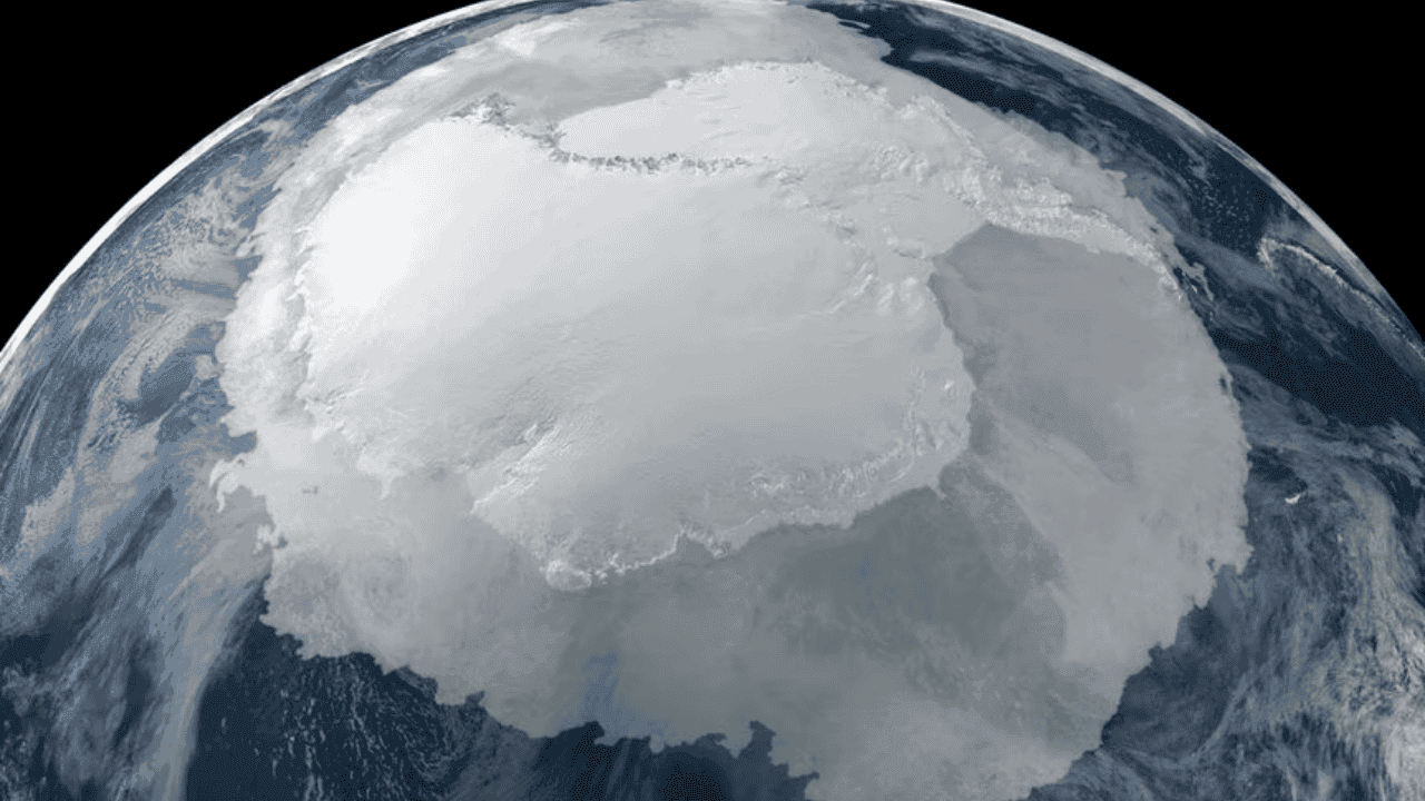
When you look at images of Antarctica from Space, it’s hard not to feel awe. The icy continent stretches endlessly, a vast white canvas punctuated by jagged mountain ranges, frozen valleys, and massive glaciers. These images aren’t just breathtaking—they tell a story about our planet’s climate, history, and the fragile balance of life on Earth. Seeing Antarctica from orbit is like looking at Earth through a new lens, one that reveals both its beauty and its vulnerability.
What Does “Antarctica from Space” Really Mean?
When people think of seeing Antarctica from space, many imagine a single perfect photo captured in one click. In reality, most satellite images are mosaics or composite images, stitched together from hundreds of shots taken over time. Satellites like NASA’s MODIS or ESA’s Copernicus Sentinel-1 orbit the Earth continuously, gathering data that scientists transform into images humans can understand.
This distinction matters: these images aren’t just for aesthetics. They provide critical scientific data about ice thickness, glacial movement, and climate changes happening in real-time. Understanding how satellites capture Antarctica ensures we interpret these visuals correctly—and appreciate the incredible technology behind them.
How Satellites Reveal Antarctica’s Secrets
Pressure and Ice: Antarctica’s Dynamic Surface
From space, Antarctica appears uniform at first glance, a frozen white desert. But closer observation reveals a complex landscape:
- Glaciers moving slowly toward the ocean.
- Subglacial lakes, hidden beneath kilometers of ice, like the mysterious Lake Vostok.
- Mountain ranges that pierce the ice, including the Transantarctic Mountains.
Satellites can track these features with precision, revealing subtle changes in ice mass that signal climate trends. When glaciers accelerate or ice shelves thin, it warns scientists about potential sea-level rise affecting millions around the world.
Temperature and Reflection: Why Antarctica Appears So Bright
The continent’s reflective snow and ice, known as albedo, bounce sunlight back into space. Satellites detect this reflection, helping climatologists understand global energy balance. Changes in albedo can indicate melting ice or shifting snow patterns—early warnings of climate change in action.
Comparing Past and Present: A Frozen Time Capsule
Antarctica isn’t just a frozen desert; it’s a living record of Earth’s past. Ice cores drilled deep into its sheets reveal layers of snow deposited over hundreds of thousands of years. By analyzing these layers, scientists can study ancient climates, greenhouse gas levels, and even volcanic eruptions that influenced global weather patterns.
Modern satellite imagery complements this historical record, providing real-time monitoring of changes that took millions of years to accumulate. Together, space imagery and ice core data create a full picture of Antarctica’s story—from past to present.
🔗 Internal Resource: Explore more about Earth’s history here: Earth 4.5 Billion Years Ago
Why Antarctica from Space Matters for Climate Science
Satellites observing Antarctica are more than just photographers in orbit—they are scientists in space. These observations allow researchers to:
- Track ice sheet dynamics to predict global sea-level changes.
- Monitor seasonal snow cover for climate models.
- Detect glacial calving events, where massive chunks of ice break off into the ocean.
Every pixel of satellite data contributes to understanding Earth’s climate system, influencing policies and raising awareness about global warming. Images of Antarctica from space turn abstract numbers into tangible, emotional evidence of climate change.
Human Perspective: Feeling Small in a Vast White World
There’s an emotional side to seeing Antarctica from orbit. Astronauts describe the continent as a silent, immense wilderness, with no visible human settlements, only nature in its purest form. The whiteness can feel endless, and the scale overwhelming, giving a new perspective on our place on Earth.
These images encourage people to think globally—our planet is interconnected, fragile, and worth protecting. Seeing Antarctica from space isn’t just science; it’s a reminder of the responsibility we have to preserve it.
Side-by-Side Comparison: Antarctica Then and Now
| Feature | Past Observations | Modern Satellite Insights |
|---|---|---|
| Ice Sheet Extent | Limited ground surveys | Detailed full-continent mapping |
| Glacial Movements | Estimated | Measured precisely with radar |
| Climate Data | Ice cores & weather stations | Real-time monitoring of ice loss & temperature |
| Sea-Level Impact | Modeled | Direct correlation with melting glaciers |
| Human Footprint | Minimal exploration | Research stations monitored for environmental impact |
FAQ: Antarctica from Space
1. Can we see Antarctica from the International Space Station?
Yes! Astronauts often capture images of the continent from orbit, but these are partial views. Complete maps come from satellites that systematically cover the entire region.
2. Why do satellites take composite images?
Because no single shot can capture the vast continent at once. Composite images ensure full coverage and high resolution.
3. How does space imagery help fight climate change?
Satellites track ice loss, glacial movements, and surface temperature changes, providing critical data to model future sea-level rise.
4. Are these images natural color?
Many are enhanced for clarity. Some show true color, while others highlight specific data like temperature, ice thickness, or snow accumulation.
Conclusion: Antarctica from Space—A Window to Our Planet
Seeing Antarctica from Space is more than awe-inspiring imagery; it’s a powerful tool for science, climate awareness, and global perspective. Satellites reveal the intricate beauty of glaciers, mountains, and hidden lakes, while also alerting humanity to urgent environmental changes.
Through these images, we learn about the past, present, and future of our planet, bridging technology and emotion in ways that make Antarctica both a scientific marvel and a source of global inspiration.
🔗 Outbound Source: For official NASA imagery and science on Antarctica from space, visit NASA Earth Observatory.

Muzamil
My name is Muzamil, and I am the founder of Spacem12 — a space exploration platform born out of a lifelong fascination with the cosmos. Like many who look up at the night sky and feel something stir, my passion for space began not in a classroom or a laboratory, but simply through curiosity. As a dedicated hobbyist, I found myself spending countless hours reading about rocket launches, distant galaxies, planetary missions, and the extraordinary people who dedicate their lives to exploring the unknown. Over time, I realized that much of the most exciting space content was either too technical for everyday readers or scattered across dozens of different sources. I started Spacem12 to change that — to create a single destination where anyone, regardless of their background, can explore the wonders of the universe in a clear, engaging, and accurate way. Spacem12 is built on the belief that space belongs to everyone. Whether you're a student discovering astronomy for the first time, a curious mind following the latest missions, or a fellow enthusiast who simply can't stop watching rocket launches — this site is for you. The universe is vast. The journey is just beginning.
View all posts